Showcasing how Earth Observation data can help inform nature-relevant decision-making in cities
The European Space Agency (ESA), in collaboration with the Urban Nature Program, hosted this webinar to showcase how Earth Observation (EO) data can support nature-relevant decision-making in cities, with a particular focus on climate adaptation and urban nature outcomes. The session introduced ESA’s work in promoting the use of EO data within development and climate finance, and explore how satellite and complementary datasets can help cities address practical planning, policy, and investment questions.
Through a short framing discussion and a set of concrete city case studies, the webinar illustrated how EO tools are being applied to assess climate risks, understand the benefits of urban green and blue infrastructure, and inform nature-positive urban interventions. The examples presented drew from both Global North and Global South cities and highlight how partnerships between space agencies, service providers, and cities can translate data into actionable insights for urban decision-making. The session concluded with an interactive discussion and an overview of upcoming Urban Nature Network activities.
Earth Observation Introduction
Climate change is one of the main challenges facing cities today. Rising temperatures, more frequent heatwaves, heavier rainfall, flooding, droughts, and sea-level rise are already affecting urban areas around the world. Because cities concentrate people, infrastructure, and economic activities, these impacts can disrupt daily life, damage assets, and increase social inequalities if they are not properly addressed.
Adapting to climate change requires a solid understanding of climate-related risks. Without knowing what risks exist, where they occur, and who or what is affected, it is difficult for cities to design effective adaptation strategies. Climate risk analysis helps decision-makers prioritize actions, allocate resources efficiently, and reduce potential damages before extreme events occur.
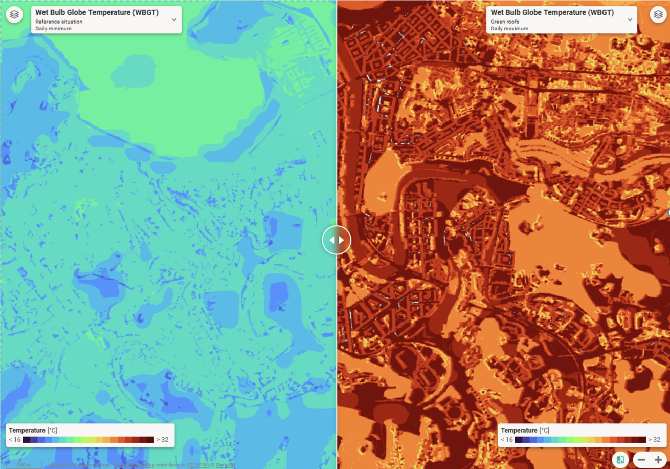
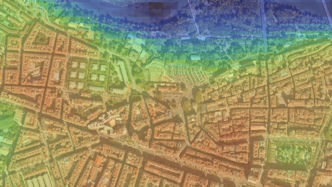
According to the Intergovernmental Panel on Climate Change (IPCC), climate risk is defined by the interaction of three main components: hazard, exposure, and vulnerability. Hazards refer to potentially harmful climate-related events or trends, such as floods, heatwaves, or storms. Exposure describes the presence of people, buildings, infrastructure, or economic activities in areas that could be affected by these hazards. Vulnerability reflects how susceptible these exposed elements are to harm and includes both sensitivity (how strongly they are affected) and adaptive capacity (their ability to cope, adapt, or recover). These risk definitions provide a clear and structured framework to assess climate risks in a consistent and transparent way. They help translate complex climate information into practical knowledge that can support urban planning, policy design, and risk reduction measures.
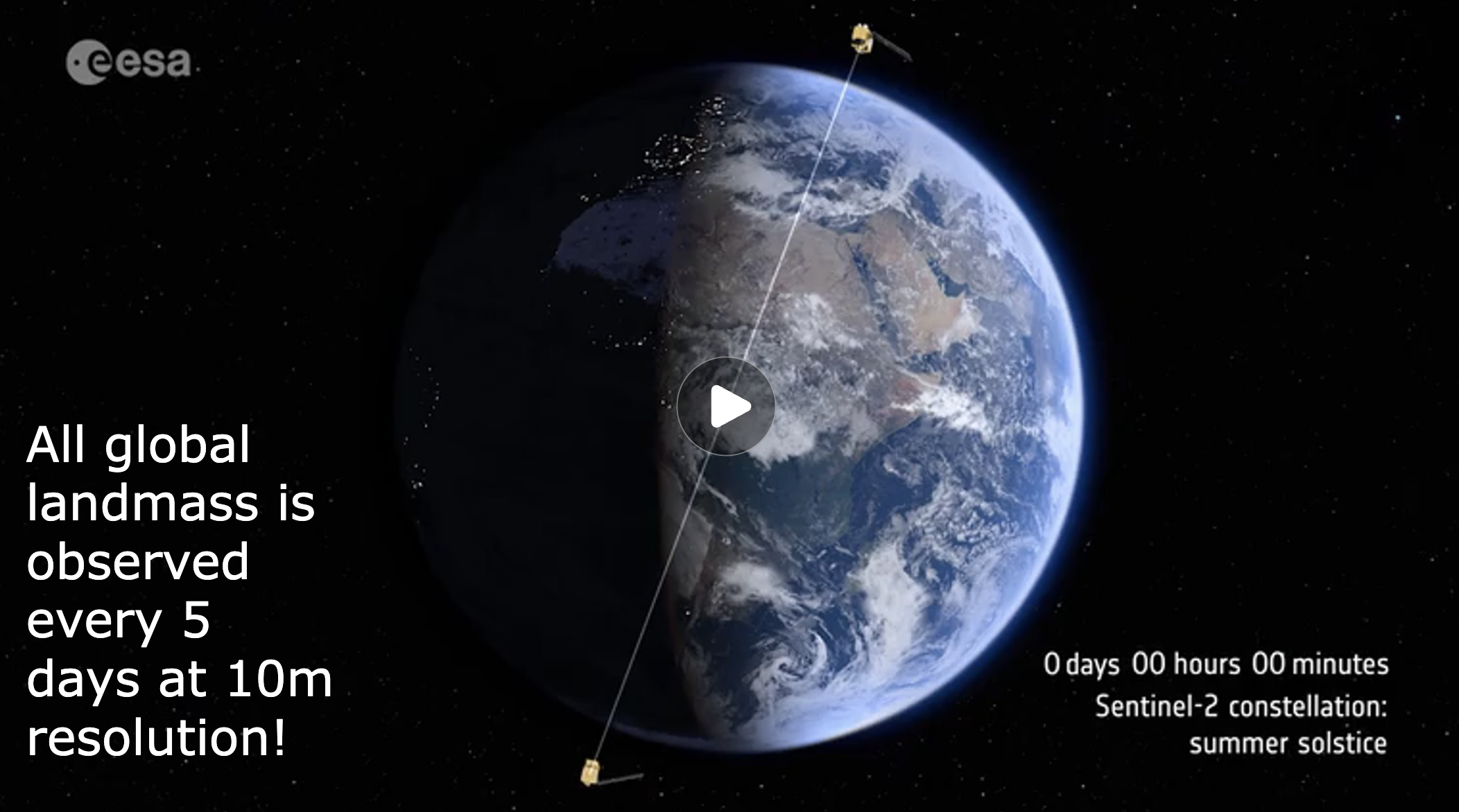
Earth observation is a highly valuable resource for climate risk analysis. Satellite data and other remote sensing products provide consistent, spatially detailed, and up-to-date quantitative information that can support all risk components. For hazards, earth observation can identify flood-prone areas, monitor land surface temperatures, or track drought conditions. For exposure, it can reveal land use changes, urban expansion, and the location of critical infrastructure. Sensitivity can be assessed using data on building characteristics or infrastructure types, while adaptive capacity can be informed by indicators such as green spaces, natural capital, and the presence of nature-based solutions. Together, these insights help cities better understand and manage climate risks.
| Time | Item | Speaker |
14:30 (5 min) | Opening | Xueman Wang, Program Manager for GPSC, World Bank |
14:35 (5 min) | Welcome and introduction to ESA and its GDA Climate Adaptation Integrating nature and low carbon into neighborhood regeneration | Alex Chunet, ESA Specialist, European Space Agency
|
14:40 (5 min) | What sort of questions can EO help with? | Efren Feliu Torres, Climate Change Adaptation Manager, Tecnalia |
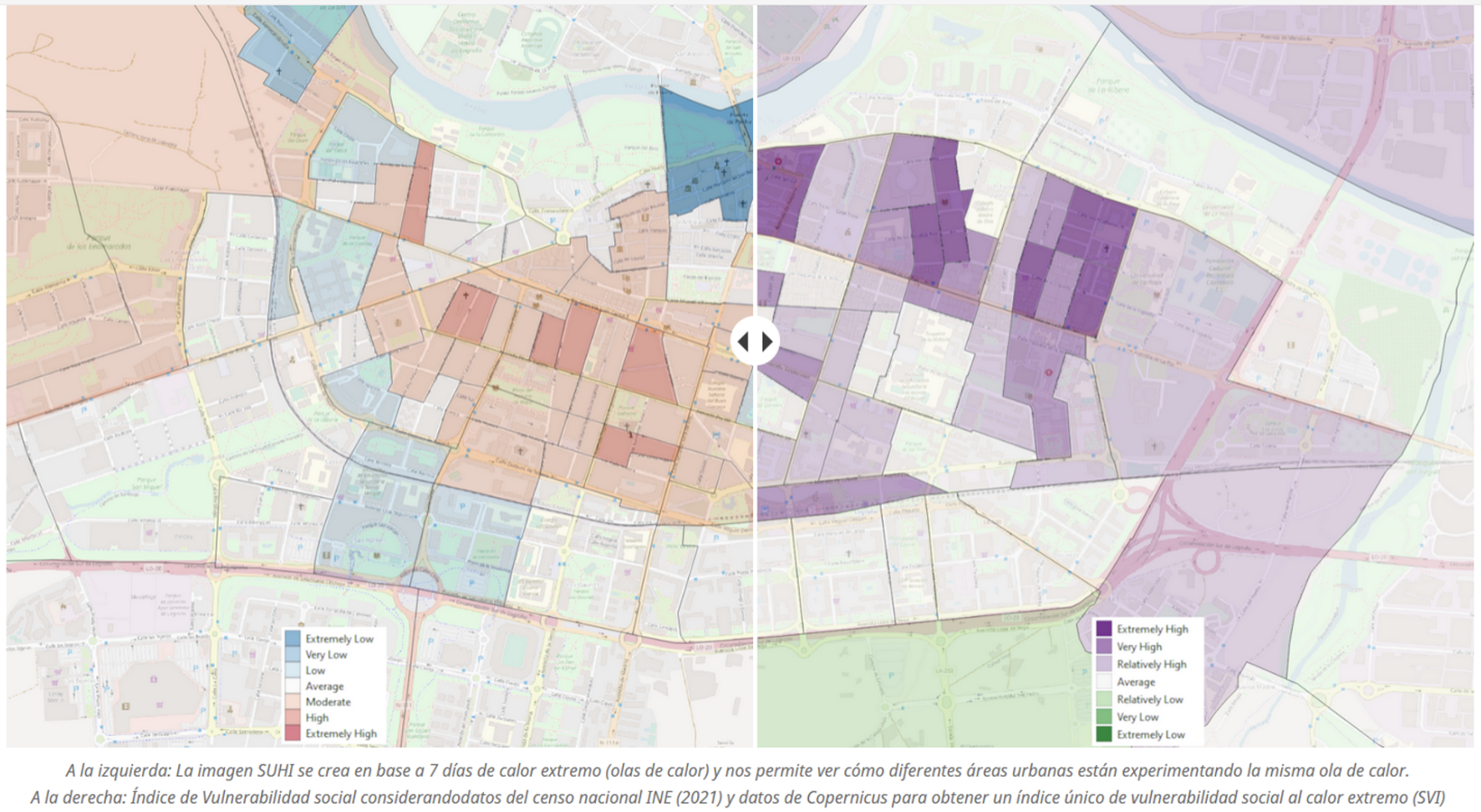
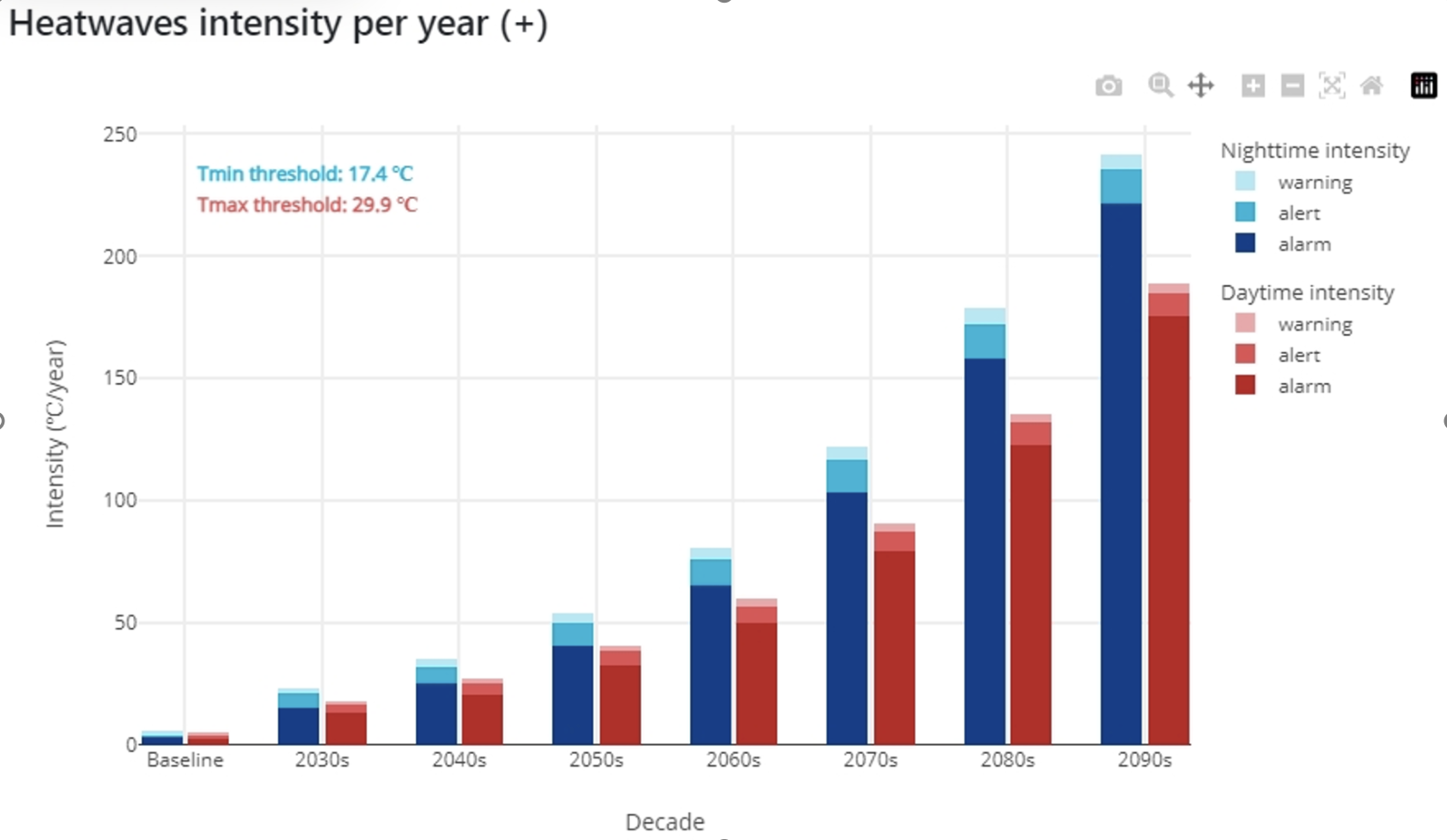
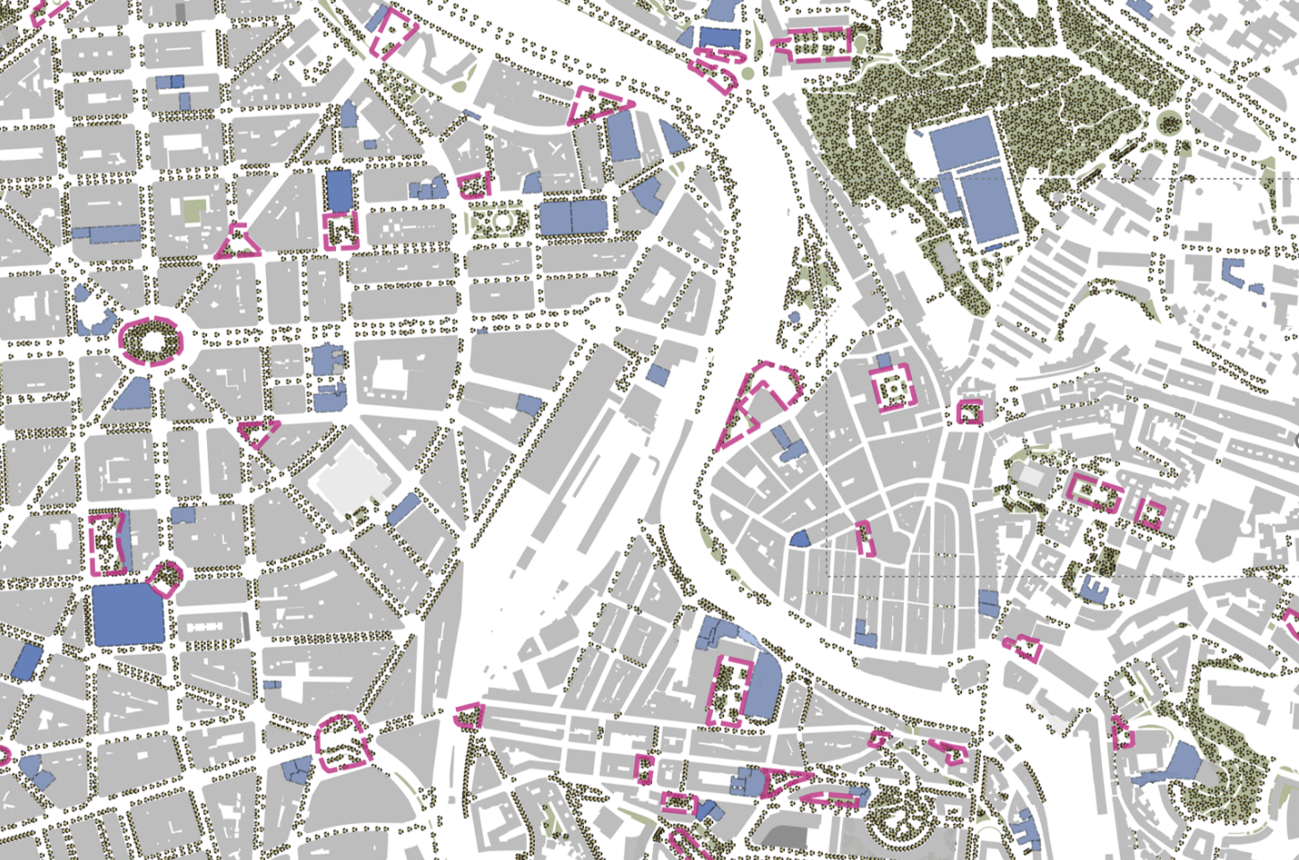
14:45 (30 min) | Case Study Presentations Case study 1: Dakar, Senegal – Modelling environmental benefits of new urban parks. Case study 2: Medellín, Colombia – A vulnerability assessment of greenspace benefits (heat, air pollution, wellbeing). Case study 3: Logroño, Spain - Identifying heat hotspots using land surface temperature and social vulnerability data | Speakers David Fletcher, PhD Associate, UK Centre for Ecology & Hydrology Laurence Jones, Professor, UK Centre for Ecology & Hydrology
Nieves Peña , Climate Change Researcher, Tecnalia
Chair Nicki McGoh, Senior Director, Funds & Programs, Caribou |
15:15 (25 min) | Q&A from participants | Nicki McGoh, Senior Director, Funds & Programs, Caribou |
15:40 (5-10 min) | Next Steps Details of second webinar and other Urban Nature Network activities | Nicki McGoh, Senior Director, Funds & Programs, Caribou |
1 min
| Closing | GPSC, World Bank |