Saint-Louis

AREA:
63.54 km²
POPULATION:
254,171 (2023 census)
Senegal

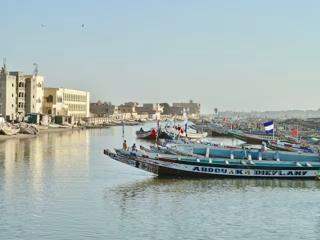
Saint-Louis, located at the mouth of the Senegal River, is a UNESCO World Heritage Site and one of West Africa’s most climate-vulnerable coastal cities. Participating in the GEF-6 Global Platform for Sustainable Cities (GPSC), Saint-Louis is integrating climate risks into urban planning and infrastructure design. The project enhances capacity for city management, promotes climate-resilient housing and public infrastructure, and strengthens national urban policy frameworks. Through the preparation of a Sustainable Cities Master Plan, Saint-Louis develops a strategic vision and pilot investments to address sea level rise, flooding, and coastal erosion. These interventions aim to safeguard the city’s cultural heritage, protect livelihoods, and promote sustainable, adaptive urban development along Senegal’s coastline.

Recent Initiatives

Transit-Oriented Development

What is TOD? Why TOD Matters From Concept to Practice Making TOD Work Explore Resources Transit-Oriented Development (TOD) is an integrated approach to urban planning that aligns transport, land use

Municipal PPP

What is Municipal PPP? Why Municipal PPP Matters Understanding the Context The PPP Project Cycle Municipal PPP Framework Municipal Public-Private Partnerships (PPPs) are long-term collaborations

Gender and Cities

Why Gender Matters Our Approach What We Do Explore Our Resources Featured Resources Gender equality is essential to achieving sustainable, resilient, and inclusive cities. Climate change

Theme

Keywords

Related Content

EO4SD-Urban Project: Saint Louis City Report GPSC is providing cities with urban extent imagery to facilitate a finer-grained understanding of urban expansion. This GPSC knowledge product for Saint Louis contains information related to the
Knowledge Product