City Overview
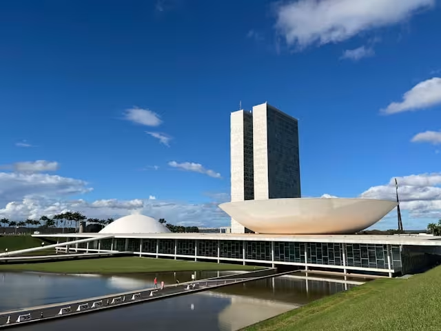
Brasilia is located in one of Brazil’s driest ecosystems and its population is rapidly growing, and the city’s water consumption is expected to outstrip supply in the next 3 years. The planning Company of the Federal District (CODEPLAN) estimates that in 2030, Brasilia will have 1 million inhabitants more than today. This will not only create an increasing pressure on the surrounding land, but also on surrounding resources, and drinking water. Urban expansion and drinking water shortage are prevailing problem in Brazil and in other fast-growing economies.
To undergo diagnostic assessments to identify problems and gaps in current development, the GPSC will integrate the USF indicators with the existing indicators that city is currently using to conduct a rapid assessment exercise. In terms of adapting to climate change, the GPSC Resources Team will be able to provide more support and advise with regards to mainstreaming climate change risks into urban plans. In addition, for using advanced technologies to better support integrated urban planning process through scenario modelling, geospatial tools and so on. The E04SD consortium will also be able to provide geospatial data and capacity training to urban planners.
In spite of being a young city, Brasilia presents chronic and structural problems common to most of the great Brazilian cities. Disorganized urban sprawl has led the city to put pressure on natural resources, particularly water. Brasília presents low water availability because it is located in the plateau, presents small rivers and a climate with 6 months of drought. In recent years, there has been a rise in temperature in the dry season and a reduction of precipitation in the rainy season, which has taken the city to the critical state in relation to water.
Human pressure increases over the territorial space, natural resources, and infrastructure available with the migration of about 60,000 new residents per year to the Capital. The ongoing efforts are to build resilient cities in the DF - particularly resilient to water (both surface and groundwater). To do so, an ecological-economic zoning was made (a land use policy) that will enable a review of land use planning and other urban planning tools based on the analysis of environmental data. The deepening of the diagnosis made regarding the ecological infrastructure and the efforts for the evolution of the instruments for the urban planning and management has been achieved through the adoption of advanced geospatial tools and scenarios, in order to support the process of integrated urban planning and management. The project aims to organize the data available, its exploration under new horizons, from the exchange of experiences between cities and with the Observatory of Cities and the Global Platform. The reduction of the learning curve and the qualification of the State decision-making should be reinforced with the training in geospatial data analysis (E04SD Consortium) and comparative analysis of the indicators (GPSC and USF) in the monitoring process.